
MIAMI VALLEY — A Winter Weather Advisory has been issued for Montgomery, Greene, Clark, Champaign, Miami, Logan, Clinton, Warren, and Butler from 7 a.m. until 7 p.m. Sunday.
A Winter Weather Advisory has been issued for Preble, Mercer, Darke, and Shelby Counties from 4 a.m. until 7 p.m. Sunday.
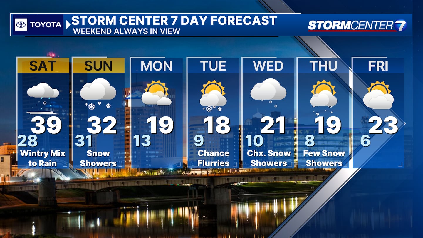
A complex forecast lies ahead this weekend for the Miami Valley.
[DOWNLOAD: Free WHIO-TV News app for alerts as news breaks]
TRENDING STORIES:
- Former Ohio State quarterback, team captain dies
- Officers, medics respond after SUV rolls over in Vandalia neighborhood
- Officers, medics respond after SUV rolls over in Vandalia neighborhood
Storm Center 7 Chief Meteorologist Austin Chaney said the wintry mix is moving in a little ahead of schedule.
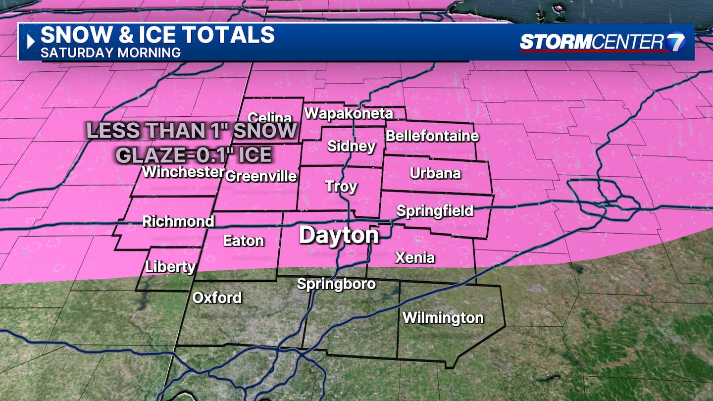
Snow and freezing rain have been reported and will continue on and off into the morning hours.
Light snow and ice accumulations are likely. Snow will generally amount to .5″ or less and .1 to .2″ of ice is possible.
We will see every precipitation type between Saturday and Sunday.
Chaney said there is high confidence in how Saturday will play out. However, there’s lower confidence with still a very large spread in snow totals for Sunday.
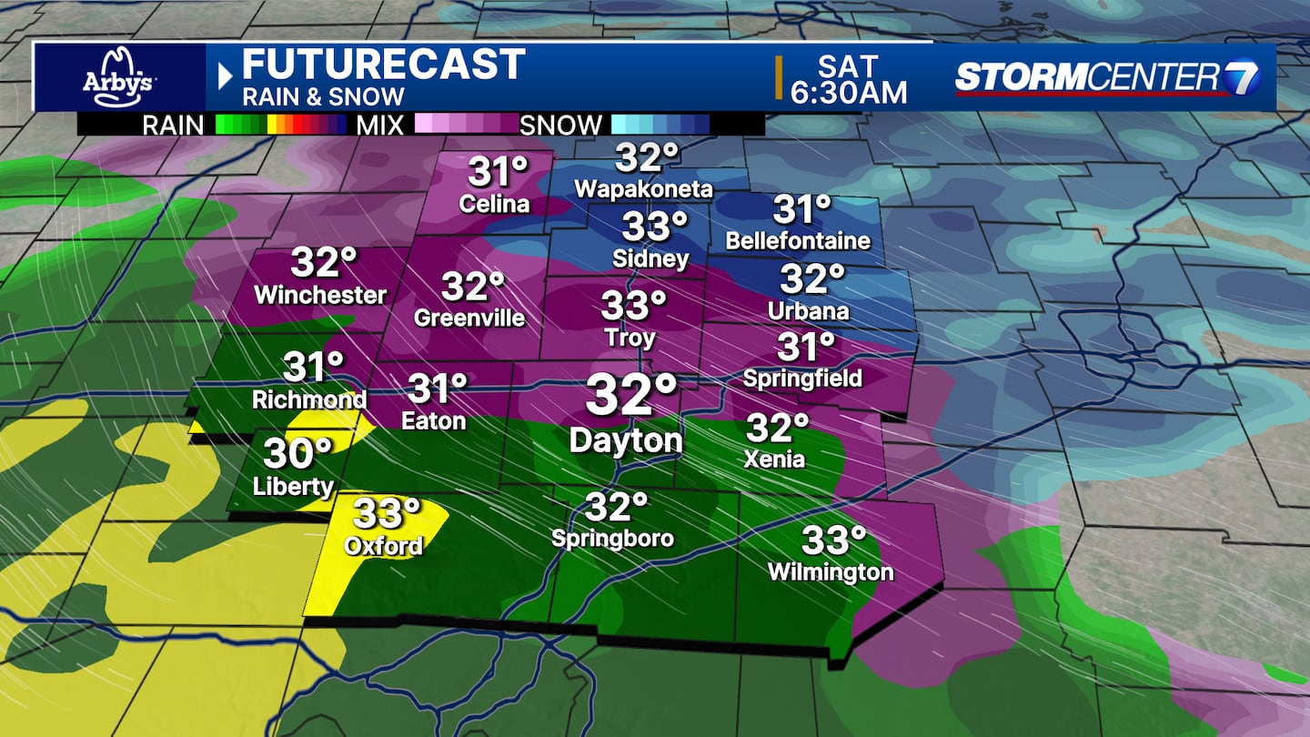
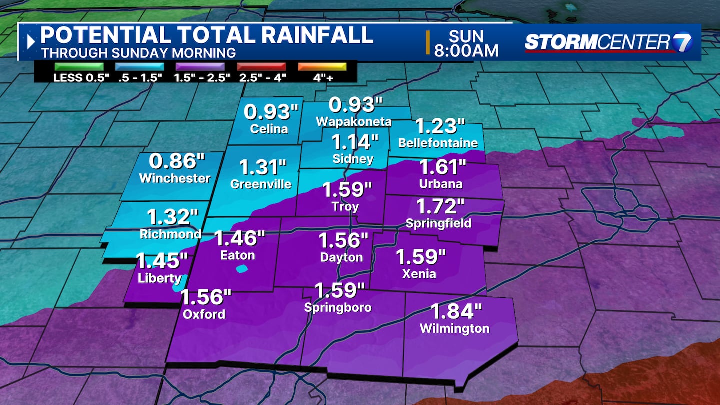
By the time we get to daybreak on Saturday, we’re mainly looking at freezing rain transitioning to rain. On and off rain showers are likely throughout the day.
Temperatures slowly rise, reaching the upper 30s by evening. Rain will continue through Sunday morning as the temperatures will not cool off.
Rainfall totals of 1-2 inches, isolated 3 inches possible.
None of our counties are currently included in any flood alerts, according to Chaney.
We’ll watch the trends closely to see if any flood concerns migrate into our region.
Regardless of any true flooding, muddy/soggy soil, some rise in rivers, creeks, and streams is likely, Chaney said.
People with sump pumps should make sure those are working heading into Saturday night.
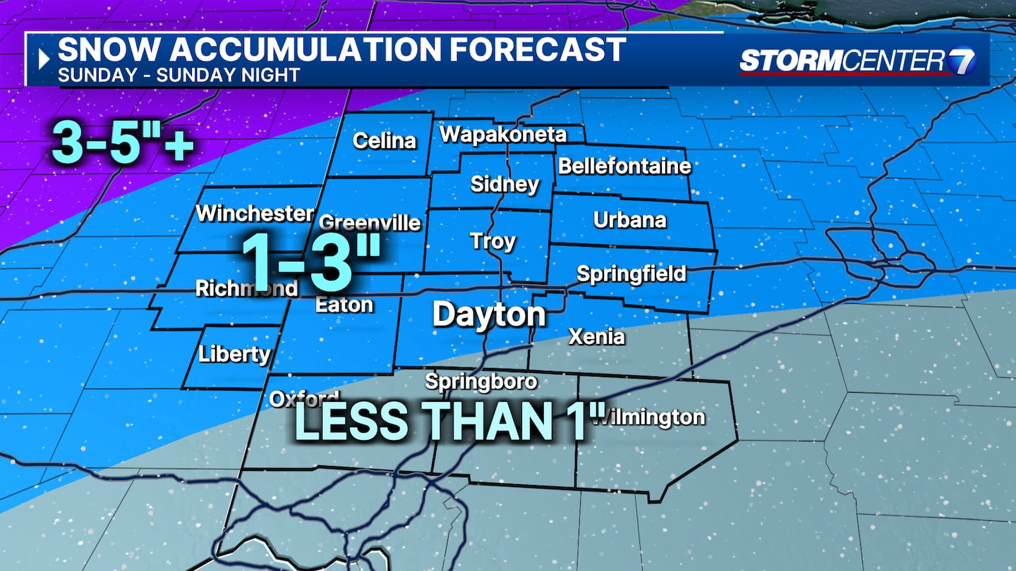
Chaney said colder air wraps back in on Sunday and precipitation changes back over to snow showers.
It looks like we’ll be in a spot where snow showers are likely on Sunday, but the heaviest snow misses us just to the northwest.
Locally, totals of 1-3 inches are possible by Sunday night, Chaney said.
Two things can still change this part of our forecast. A shift in the track southeast or faster arriving cold air could increase these totals.
Slower arriving cold air or more of a northwesterly track could do the opposite. Strong winds are likely Sunday with gusts at 30 to 35 mph with an isolated 40 mph possible.
On Monday, some flurries are possible early, then partly cloudy. Very cold with highs in the upper teens to around 20. Wind chills below zero for at least the morning hours.
[SIGN UP: WHIO-TV Daily Headlines Newsletter]
©2025 Cox Media Group
 Sign Up

